Manila City
Manila (Tagalog: Maynila; pronounced /majˈnilaʔ/ in Tagalog; pronounced /məˈnɪlə/ (mə-NIL-ə) in English) is the capital of the Philippines. It is one of the sixteen cities comprising Metro Manila.
Manila is located on the eastern shores of Manila Bay and is bordered by Navotas and Caloocan to the north, Quezon City to the northeast, San Juan and Mandaluyong to the east, Makati on the southeast, and Pasay to the south.
Manila has a total population of more than 1,660,714 according to the 2007 census. Manila is the second most populous city in the Philippines behind Quezon City. The populace inhabit an area of only 38.55 square kilometers, making Manila the most densely populated city in the world.[5] However, Metro Manila is the most populous metropolitan area in the Philippines and the 11th in the world with an estimated population of 16,300,000. The greater urban area is the fifth-largest in the world with an estimated population of 20,654,307 people.[6]
The city is divided into six legislative districts and consists of sixteen geographical districts: Binondo, Ermita, Intramuros, Malate, Paco, Pandacan, Port Area, Quiapo, Sampaloc, San Andres, San Miguel, San Nicolas, Santa Ana, Santa Cruz, Santa Mesa and Tondo. Within their precincts can be found areas of bustling commerce and some of the most historically and culturally significant iconic landmarks in the country as well as the seat of the executive and judicial branches of the government. It is home to many scientific and educational institutions, as well as numerous sport facilities. These make the city a major political, commercial, cosmopolitan, cultural, educational, religious, and transportation center of the
History
The earliest written account of the city is the 10th Century Laguna Copperplate Inscription which describe an Indianized kingdom maintaining diplomatic relations with the Kingdom of Medang and commercial exchanges with Ancient Japan and Song Dynasty China. The city was invaded by Brunei's Sultan Bolkiah and was already Islamized by the 15th century when the Spanish first arrived. Manila eventually became the center of Spanish activity in the Far East and one end of the Manila–Acapulco galleon trade route linking Latin America and Asia. This caused it to be called the "Pearl of the Orient". Several Chinese insurrections, local revolts, a British Occupation and a Sepoy mutiny also occurred thereafter. Later, it saw the rise of the Philippine Revolution which was followed by the arrival of the Americans who made contributions to the city's urban planning and development only to have most of those improvements lost in the devastation of World War II. Since then the city has been rebuilt.
Manila was first known as Ginto (land of gold) or Suvarnadvipa by its neighboring provinces, and was officially the Kingdom of Maynila. The Kingdom of Maynila flourished during the latter half of the Ming Dynasty as a result of trade relations with China. Ancient Tondo was maintained as the traditional capital of the empire. Its rulers were equivalent to kings and not mere chieftains, and they were addressed as panginuan or panginoon ("lords"), anak banwa ("son of heaven") or lakandula ("lord of the palace"). During the 13th century, the city consisted of a fortified settlement and trading quarter at the shores of the Pasig river, on top of previous older towns. There is also early evidence of Manila being invaded by the Indianized empire of Majapahit, due to the epic eulogy poem Nagarakretagama which inscribed its conquest by Maharaja Hayam Wuruk.[7] Saludong or Selurong which is a historical name for the city of Manila is listed in Canto 14 alongside Sulot, which is now Sulu, and Kalka.[7]
During the reign of Sultan Bolkiah in 1485 to 1521, the Sultanate of Brunei decided to break the Dynasty of Tondo's monopoly in the China trade by attacking it and establishing the state of Selurong (now Manila) as a Bruneian satellite-state.[8] A new dynasty under the Islamized Rajah Salalila. was also established to challenge the House of Lakandula in Tondo. Islam was further strengthened by the arrival to the Philippines of traders and proselytizers from Malaysia and Indonesia.[9] The multiple states that existed in the Philippines simplified Spanish colonization. Manila was temporarily threatened by the invasion of Chinese pirate-warlord Limahong before it became the seat of the colonial government of Spain.
In 1571 Spanish conquistador Miguel Lopez de Legazpi founded the Manila in what today is Intramuros. Manila was made the capital of the Philippine Islands, which Spain would control for over three centuries, from 1565 to 1898. The city was occupied by Great Britain for two years from 1762 to 1764 as part of the Seven Years' War.[10] The city remained the capital of the Philippines under the government of the provisional British governor, acting through the Mexican-born Archbishop of Manila, Manuel Rojo del Rio y Vieyra and the captive Real Audiencia.[11] However, armed resistance to the British persisted, centered in Pampanga, and was led by Oidor Don Simón de Anda y Salazar.[11]
Manila also became famous during the Manila-Acapulco galleon trade which lasted for three centuries and brought goods from as far as Mexico and Peru all the way to Southeast Asia. Silver that was mined in Mexico and Peru were exchanged for Chinese silk, Indian gems, and the spices of the East Indies.
In 1898, Spain ceded the Philippines to the United States. Under the American control, the new government invited Daniel Burnham to plan a modern Manila.[12] The Burnham Plan was a project that attempted to create Manila as Paris on the Prairie, with a vision of a government center occupying all of Wallace Field, which extends from Luneta to the present Taft Avenue. The Philippines Capitol was to rise on the Taft Avenue end of the field, facing toward the sea, and would form, with the buildings of different government bureaus and departments, a mighty quadrangle, lagoon in the center and a monument to Rizal at its Luneta end. Of Burnham’s proposed government center, only three units were built: the Legislative Building and the building of the Finance and Agricultural departments, which were completed on the eve of the War. By then, President Manuel L. Quezon had doomed the Burnham Plan by creating a new capital outside Manila, which was named after him, Quezon City.
Manila was the site of the most fierce battle in the Pacific theater during the war. During the battle, Manila became a city of bloodbath in Asia where 100,000 civilians were killed.[13] It was the second most devastated city in the world after Warsaw during the Second World War. Since then the city has been rebuilt.
With Arsenio Lacson becoming the first elected mayor (prior to this all mayors were appointed), Manila underwent The Golden Age,[14] Manila was revitalized and became once again the pearl of the orient, which Manila has earned before the outbreak of World War II. During the Marcos dictatorship, the region of the Manila metropolitan area was enacted as an independent entity in 1975 encompassing several cities and towns, being as a whole the seat of government of the Philippines.
On 1992, Alfredo Lim became the mayor, and was known for his anti-crime crusades. When Lim ran for the presidency during the 1998 presidential election, his vice mayor Lito Atienza was elected as city mayor. Atienza was known for renovating most of the city's plaza, and projects that would benefit the populace. He was the Mayor of Manila for 3 terms (9 years); barred for seeking a fourth consecutive term. Lim defeated Atienza's son Ali in the 2007 city election and immediately reversed all of Atienza's projects[15] claiming the projects made little contribution to the improvements of the city. On July 17, 2008, councilor Dennis Alcoreza, filed human rights complaints before the Commission on Human Rights, against Lim, and other Manila officials.[16] Twenty four Manila officials also resigned because of the maltreatment of Lim's police forces.
While the eastern part of Manila faced a catastrophe during the flooding of Tropical Storm Ketsana in 2009, the only major inconvenience in the city was the flooded Quezon Boulevard underpass which took two days to clean up and the district of Santa Mesa, the most flooded area within the city. During the 2010 city elections, Alfredo Lim won against secretary Lito Atienza. After a few months of taking office, Lim was harshly criticized on the bloody resolution of the Manila hostage crisis, one of the deadliest hostage crisis in the Philippines.
Demographics
As of the 2007 census, the population of the city was 1,660,714 making it the second most populous city in the Philippines.[3] The metropolis of Metro Manila is the 5th largest urban area in the world with a population of 20,654,307 people (2010 estimate).[6]
It is the most densely populated city in the world with 43,079 inhabitants per km2.[5] District 6 is listed as being the most dense with 68,266 inhabitants per km2, followed by the first two districts with 64,936 and 64,710, respectively, and district 5 being the least dense with 19,235.[28]
Manila's population density dwarfs that of Kolkata (27,774 inhabitants per km2), Mumbai (22,937 inhabitants per km2), Paris (20,164 inhabitants per km2), Dhaka (19,447 inhabitants per km2), Shanghai (16,364 inhabitants per km2), with its most dense district of Nanshi's 56,785 density), and Tokyo (10,087 inhabitants per km2).[29]
But when accounting for the entire urban area, Metro Manila drops to 60th place with 14,100 people/km2 in a land area of 1,425 km2, which includes the area of Greater Manila Area.[4]
The vernacular language is Filipino, based mostly on the Tagalog of surrounding areas, and this Manila form of speaking Tagalog has essentially become the lingua franca of the Philippines, having spread throughout the archipelago through mass media and entertainment. Meanwhile, English is the language most widely used in education and business throughout the Metro Manila region. A number of older residents can still speak basic Spanish, which was a mandatory subject in the curriculum of Philippine universities and colleges, and many children of European, Arab, Indian, Latin American, or other migrants or expatriates also speak their parents' languages at home, aside from English and/or Filipino for everyday use. Minnan Chinese (known as Lannang-oe) is spoken by the city's Chinese-Filipino community.
Economy
Manila's economy is diverse and multifaceted. With its excellent protected harbor, Manila serves as the Chief Seaport of the Country, as the Port of Manila is one of the busiest in the world. Diverse manufacturers produce industrial-related products such as chemicals, textiles, clothing, and electronic goods. Food and beverages and tobacco products also produced. Local entrepreneurs continue to process primary commodities for export, including rope, plywood, refined sugar, copra, and coconut oil. The food-processing industry is one of the most stable major manufacturing sector in the city. Manila is a major publishing center in the Philippines.[30]
One of the largest projects within the city is the ₱5,000,000,000 development by Ayala Land Inc., the Celadon Residences.[31] Binondo has begun to be revitalized along with Divisoria, and several high-rise condominiums and offices are rising. Recently, a 20-hectare development was planned by the city government within the Port Area.[31][32] A blueprint was created for the development of the area while the city government waits for President Aquino to authorize the use of the idle land.[32] An area within the North Harbor was invested in by the San Miguel Corporation, which plan to build a ₱20,000,000,000 development known as San Miguel City. This would be a new business area located within the Metropolis which then serve the shipping requirements of the different divisions of the San Miguel Corporation.[33]
Tourism in Manila attracts over 1 million tourists each year.[30] Major destinations include the 1322 Golden Empire Tower, Intramuros, the Mendiola, museums such as the National Museum of the Philippines, and other tourist attractions including Ermita, Malate, Santa Cruz, the Manila Zoo, the City Chinatown and events such as the Feast of Black Nazarene, and free performances in Rizal Park and events within the Cultural Center of the Philippines.[note 1] Rizal Park is a major tourist attraction and one of the most recognizable icons of the Philippines. Ermita and Malate are well-known shopping destination for the upper class while Divisoria was the shopping destination for local residents.
Arts and culture
The cosmopolitan atmosphere and cultural diversity of Manila is reflected in the number of places for worshipping throughout the city. The freedom of worship in the Philippines, which has existed since the creation of the republic, allowed the diverse population to build their sacred sites without the fear of persecution. People of different denominations are represented here with the presence of Christian churches, Buddhist temples, Jewish synagogues, and Islamic mosques. Roman Catholics predominate, comprising 93.5% of the population, followed by Iglesia ni Cristo, comprising 1.9% of the population followed by Protestants (1.8%) and Buddhist (1.1%). Other religions comprises the remaining 1.4% of the city's population.[35] Manila is the seat of the Roman Catholic Archdiocese of Manila, the oldest archdiocese in the country, and the Primate of the Philippines, whose offices were located at the Minor Basilica of the Immaculate Conception.[36] Manila is home to three other basilicas, besides the Manila Cathedral, namely, the Minor Basilica of the Black Nazarene, Minor Basilica of St. Lorenzo Ruiz and the Basilica Minore de San Sebastian. Being the seat of the Spanish colonial government in past centuries, it has been used as the base of numerous Roman Catholic missions to the Philippines.
Other notable churches in the city include San Agustin Church in Intramuros, the shrine of the canonically crowned image of Nuestra Señora de Consolación y Correa, a UNESCO World Heritage Site,[36] and a favorite wedding place of notable people and one of two fully air-conditioned churches in the city; the Binondo Church, also known as Basilica Minore de San Lorenzo Ruiz; Malate Church, the shrine of Nuestra Señora de Remedios; Ermita Church, home of the oldest Marian Image in the Philippines, Nuestra Señora de Guia; Tondo Church, home of the century-old ivory image of Sto. Niño (Child Jesus); and Sta. Ana Church, shrine of the canonically crowned image of Nuestra Senora de los Desamparados.
Aside from the Evangelical Christians, Manila is also the home of most of the country's Mainline Protestants. The Pro-Cathedral of the Saint Stephen, the center of the Episcopal Diocese of Central Philippines of the Episcopal Church in the Philippines is also found in the city. The mainly Ilocano revolutionary church Iglesia Filipina Independiente is headquartered in the city.
The city also hosts other faiths. There are many Buddhist and Taoist temples built by the Chinese community in Manila. The Quiapo is home to a sizable Muslim population in Manila, where Masjid Al-Dahab is located. There is also a large Hindu temple for the Indian population, and a Sikh Temple was also erected. The Church of Jesus Christ of Latter-day Saints built a temple within the city.
Nightlife in Manila centres around Ermita and Malate, along with Intramuros. Areas in Binondo, the city's Chinatown, also attract many people, while other notable areas in the city such as Quiapo and Divisoria are known for being one of the shopping center of bargain goods. Ermita and Malate, being a popular tourist destination, showcase a wide variety of hotels, restaurants, clubs, bars, cafes, art and antique shops. The nightlife offers everything from cultural exhibitions to discothèques, casinos, entertainment lounges, and fashionable cafes.
Annual cultural events
Manila is the host of some notable cultural events. The Feast of the Black Nazarene, held every 9th of January, draws millions of devotees. Each district has its own fest locally known as fiesta, literally as festivals, after achieving recognition in their own rights. The Manila Day, was first proclaimed by Herminio A. Astorga (then Vice Mayor of Manila) on June 24, 1962. Since then, it has been annually commemorated the founding of the city, under the patronage of John the Baptist.
Museums and other points of interest
As the cultural center of the Philippines, Manila houses a number of notable museums. Bahay Tsinoy, one of Manila's most prominent museums, documents the Chinese lives and contributions in the history of the Philippines. The Intramuros Light and Sound Museum chronicles the Filipinos desire for freedom during the revolution under Rizal's leadership and other revolutionary leaders. The Metropolitan Museum of Manila exhibits the Filipino arts and culture. The Museum of Manila is the city-owned museum that exhibits the city's culture and history.
Manila is also home to other notable museums of the country, namely the Museo Pambata, a children's museum, the Museum of Philippine Political History, which exhibits notable political events in the country, the National Museum of the Philippines (which includes the Museum of the Filipino People) of which exhibits life, culture and history of the country, the Parish of the Our Lady of the Abandoned and the San Agustin Church Museum, which houses religious artifacts, Plaza San Luis, a public museum, the UST Museum of Arts and Sciences and the DLS-CSB Museum of Contemporary Art and Design (mcad), both of which are university museums dedicated to science and technology, and contemporary art respectively.
Numerous notable landmarks are located in Manila, such as Rizal Park, and the historical Intramuros. Rizal park is a crescent-shaped 58 hectare (143 acres)[37] park that lies within the heart of Manila's cultural and business district, as an honor and dedication to the country's national hero José Rizal, who was executed in the same place where the park was created by the Spaniards on charges of subversion. Among the attractions in Rizal Park is the Chinese and Japanese Gardens, the National Museum of the Philippines, The National Library of the Philippines, the Planetarium, the Orchidarium and Butterfly Pavilion, the park auditorium, a landscaped relief map of the Philippines, the fountain, the children's lagoon, the chess plaza, the Quirino Grandstand and the Manila Ocean Park, which features a wide variety of marine animals. The flagpole west of the Rizal Monument is the Kilometer Zero marker for distances to the rest of the country. In the northern most part of the city lie three cemeteries: the Loyola and Chinese cemeteries, and Manila North Green Park, the largest public cemetery in the Manila metropolitan area.
Sports
Sports in Manila have a long and distinguished history. The city has several well-known sports venues, such as the Rizal Memorial Sports Complex and San Andres Gym, the home of the then-Manila Metrostars. Games for this league, as well as for the PBA, take place at the Rizal Memorial Stadium and the Araneta Coliseum.[38] Manila also hosts several well-known sports facilities such as the Enrique M. Razon Sports Center and the University of Santo Tomas Sports Complex, both of which are private venues owned by a university.
Government
Main article: Legislative districts of Manila
The current mayor for the 2007–2010 term is Alfredo Lim, who is making a comeback following a three-year stint as a Senator. The city mayor is restricted to three consecutive terms, totaling nine years, although a mayor can be elected again after an interruption of one term. Isko Moreno is the city's incumbent vice-mayor. The vice-mayor heads the legislative arm composed of the elected city councilors, six from each of the city's six legislative districts. Current district representatives of the city are Benjamin Asilo, representing the 1st District, Carlo Lopez for the 2nd District, Zenaida Angping for the 3rd District, Trisha Bonoan – David for the 4th District, Amado Bagatsing in the 5th District and Rosenda Ann Ocampo in the 6th District.
Manila being the seat of political power of the Philippines, has several national government offices headquartered at the city. Planning for the development for being the center of government started during the early years of American colonialization to the country when they envisioned a well designed city outside the walls of Intramuros. The strategic location chosen was Bagumbayan, a former town which is now the Rizal Park to become the center of government and a design commission was given to Daniel Burnham to create a master plan for the city patterned after Washington D.C.. These improvements were and eventually abandoned under the Commonwealth Government of Manuel L. Quezon. A new government center was to be built on the hills northeast of Manila, or what is now Quezon City. Several government agencies have set-up their headquarters in Quezon City but several key government offices still resides in Manila. However, many of the plans were substantially altered after the devastation of Manila during World War II and the subsequent administrations.
The city, as the Official Capital, still hosts the Office of the President. Aside from these, important institutions such as the Supreme Court (Kataas-taasang hukuman), the Court of Appeals, the Bangko Sentral ng Pilipinas, the Departments of Budget and Management (Kagawaran ng Pagbabadyet at Pamamahala), Finance, Health, Justice, Labor and Employment, and Tourism still call the city home. Manila also hosts important national institutions such as the National Library, National Archives, National Museum and the Philippine General Hospital.
The city of Manila is divided into sixteen officially-defined geographical districts. These districts only exist for administrative convenience and do not have their own sets of elected officials. Each geographical district is further divided into officially-defined "zones," which are clusters of two or more barangays.
Binondo10
Ermita13
Intramuros5
Malate57
Paco43
Pandacan38
Port Area5
Quiapo16
Sampaloc192
San Andres Bukid65
San Miguel12
San Nicolas15
Santa Ana34
Santa Cruz82
Santa Mesa51
Tondo259
Data presented by the National Statistics Office still do not reflect the 16-district configuration recognized by the city government of Manila. It recognizes neither the western area of Santa Ana that now belongs to the fifth congressional district of Manila as the geographical district of San Andres Bukid, nor the area of Sampaloc south of the Ramon Magsaysay Boulevard which now belongs to the sixth congressional district as the geographical district of Santa Mesa.
Aside from the division of the sixteen geographical districts, the city is further divided into the six legislative districts of Manila that serve as the constituencies for the election of the city's representatives to the lower house of the Congress of the Philippines and of the regular members to the Sangguniang Panlungsod (City Council). Each district elects one representative to the House of Representatives and four SP members to the Sanggunian.
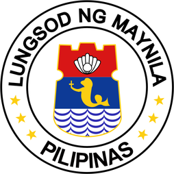
The City Seal depicts the words Lungsod ng Maynila and Pilipinas, Filipino for City of Manila and Philippines, in a circle around a shield. The circle also contains six yellow stars representing the city's six congressional districts. The city seal composes of the shield, in the shape of pre-colonial people's shield, depicts the city's nickname Pearl of the Orient on top, a sea lion in the middle, in reference to the city's Spanish influences, and the waves of the Pasig river and Manila bay in the bottom. The colors of the seal mirror that of the flag of the Philippines. The sea lion in the seal of Manila was adopted by Singapore into its merlion.
http://www.manila.gov.ph/
Manila is located on the eastern shores of Manila Bay and is bordered by Navotas and Caloocan to the north, Quezon City to the northeast, San Juan and Mandaluyong to the east, Makati on the southeast, and Pasay to the south.
Manila has a total population of more than 1,660,714 according to the 2007 census. Manila is the second most populous city in the Philippines behind Quezon City. The populace inhabit an area of only 38.55 square kilometers, making Manila the most densely populated city in the world.[5] However, Metro Manila is the most populous metropolitan area in the Philippines and the 11th in the world with an estimated population of 16,300,000. The greater urban area is the fifth-largest in the world with an estimated population of 20,654,307 people.[6]
The city is divided into six legislative districts and consists of sixteen geographical districts: Binondo, Ermita, Intramuros, Malate, Paco, Pandacan, Port Area, Quiapo, Sampaloc, San Andres, San Miguel, San Nicolas, Santa Ana, Santa Cruz, Santa Mesa and Tondo. Within their precincts can be found areas of bustling commerce and some of the most historically and culturally significant iconic landmarks in the country as well as the seat of the executive and judicial branches of the government. It is home to many scientific and educational institutions, as well as numerous sport facilities. These make the city a major political, commercial, cosmopolitan, cultural, educational, religious, and transportation center of the
History
The earliest written account of the city is the 10th Century Laguna Copperplate Inscription which describe an Indianized kingdom maintaining diplomatic relations with the Kingdom of Medang and commercial exchanges with Ancient Japan and Song Dynasty China. The city was invaded by Brunei's Sultan Bolkiah and was already Islamized by the 15th century when the Spanish first arrived. Manila eventually became the center of Spanish activity in the Far East and one end of the Manila–Acapulco galleon trade route linking Latin America and Asia. This caused it to be called the "Pearl of the Orient". Several Chinese insurrections, local revolts, a British Occupation and a Sepoy mutiny also occurred thereafter. Later, it saw the rise of the Philippine Revolution which was followed by the arrival of the Americans who made contributions to the city's urban planning and development only to have most of those improvements lost in the devastation of World War II. Since then the city has been rebuilt.
Manila was first known as Ginto (land of gold) or Suvarnadvipa by its neighboring provinces, and was officially the Kingdom of Maynila. The Kingdom of Maynila flourished during the latter half of the Ming Dynasty as a result of trade relations with China. Ancient Tondo was maintained as the traditional capital of the empire. Its rulers were equivalent to kings and not mere chieftains, and they were addressed as panginuan or panginoon ("lords"), anak banwa ("son of heaven") or lakandula ("lord of the palace"). During the 13th century, the city consisted of a fortified settlement and trading quarter at the shores of the Pasig river, on top of previous older towns. There is also early evidence of Manila being invaded by the Indianized empire of Majapahit, due to the epic eulogy poem Nagarakretagama which inscribed its conquest by Maharaja Hayam Wuruk.[7] Saludong or Selurong which is a historical name for the city of Manila is listed in Canto 14 alongside Sulot, which is now Sulu, and Kalka.[7]
During the reign of Sultan Bolkiah in 1485 to 1521, the Sultanate of Brunei decided to break the Dynasty of Tondo's monopoly in the China trade by attacking it and establishing the state of Selurong (now Manila) as a Bruneian satellite-state.[8] A new dynasty under the Islamized Rajah Salalila. was also established to challenge the House of Lakandula in Tondo. Islam was further strengthened by the arrival to the Philippines of traders and proselytizers from Malaysia and Indonesia.[9] The multiple states that existed in the Philippines simplified Spanish colonization. Manila was temporarily threatened by the invasion of Chinese pirate-warlord Limahong before it became the seat of the colonial government of Spain.
In 1571 Spanish conquistador Miguel Lopez de Legazpi founded the Manila in what today is Intramuros. Manila was made the capital of the Philippine Islands, which Spain would control for over three centuries, from 1565 to 1898. The city was occupied by Great Britain for two years from 1762 to 1764 as part of the Seven Years' War.[10] The city remained the capital of the Philippines under the government of the provisional British governor, acting through the Mexican-born Archbishop of Manila, Manuel Rojo del Rio y Vieyra and the captive Real Audiencia.[11] However, armed resistance to the British persisted, centered in Pampanga, and was led by Oidor Don Simón de Anda y Salazar.[11]
Manila also became famous during the Manila-Acapulco galleon trade which lasted for three centuries and brought goods from as far as Mexico and Peru all the way to Southeast Asia. Silver that was mined in Mexico and Peru were exchanged for Chinese silk, Indian gems, and the spices of the East Indies.
In 1898, Spain ceded the Philippines to the United States. Under the American control, the new government invited Daniel Burnham to plan a modern Manila.[12] The Burnham Plan was a project that attempted to create Manila as Paris on the Prairie, with a vision of a government center occupying all of Wallace Field, which extends from Luneta to the present Taft Avenue. The Philippines Capitol was to rise on the Taft Avenue end of the field, facing toward the sea, and would form, with the buildings of different government bureaus and departments, a mighty quadrangle, lagoon in the center and a monument to Rizal at its Luneta end. Of Burnham’s proposed government center, only three units were built: the Legislative Building and the building of the Finance and Agricultural departments, which were completed on the eve of the War. By then, President Manuel L. Quezon had doomed the Burnham Plan by creating a new capital outside Manila, which was named after him, Quezon City.
Manila was the site of the most fierce battle in the Pacific theater during the war. During the battle, Manila became a city of bloodbath in Asia where 100,000 civilians were killed.[13] It was the second most devastated city in the world after Warsaw during the Second World War. Since then the city has been rebuilt.
With Arsenio Lacson becoming the first elected mayor (prior to this all mayors were appointed), Manila underwent The Golden Age,[14] Manila was revitalized and became once again the pearl of the orient, which Manila has earned before the outbreak of World War II. During the Marcos dictatorship, the region of the Manila metropolitan area was enacted as an independent entity in 1975 encompassing several cities and towns, being as a whole the seat of government of the Philippines.
On 1992, Alfredo Lim became the mayor, and was known for his anti-crime crusades. When Lim ran for the presidency during the 1998 presidential election, his vice mayor Lito Atienza was elected as city mayor. Atienza was known for renovating most of the city's plaza, and projects that would benefit the populace. He was the Mayor of Manila for 3 terms (9 years); barred for seeking a fourth consecutive term. Lim defeated Atienza's son Ali in the 2007 city election and immediately reversed all of Atienza's projects[15] claiming the projects made little contribution to the improvements of the city. On July 17, 2008, councilor Dennis Alcoreza, filed human rights complaints before the Commission on Human Rights, against Lim, and other Manila officials.[16] Twenty four Manila officials also resigned because of the maltreatment of Lim's police forces.
While the eastern part of Manila faced a catastrophe during the flooding of Tropical Storm Ketsana in 2009, the only major inconvenience in the city was the flooded Quezon Boulevard underpass which took two days to clean up and the district of Santa Mesa, the most flooded area within the city. During the 2010 city elections, Alfredo Lim won against secretary Lito Atienza. After a few months of taking office, Lim was harshly criticized on the bloody resolution of the Manila hostage crisis, one of the deadliest hostage crisis in the Philippines.
Demographics
As of the 2007 census, the population of the city was 1,660,714 making it the second most populous city in the Philippines.[3] The metropolis of Metro Manila is the 5th largest urban area in the world with a population of 20,654,307 people (2010 estimate).[6]
It is the most densely populated city in the world with 43,079 inhabitants per km2.[5] District 6 is listed as being the most dense with 68,266 inhabitants per km2, followed by the first two districts with 64,936 and 64,710, respectively, and district 5 being the least dense with 19,235.[28]
Manila's population density dwarfs that of Kolkata (27,774 inhabitants per km2), Mumbai (22,937 inhabitants per km2), Paris (20,164 inhabitants per km2), Dhaka (19,447 inhabitants per km2), Shanghai (16,364 inhabitants per km2), with its most dense district of Nanshi's 56,785 density), and Tokyo (10,087 inhabitants per km2).[29]
But when accounting for the entire urban area, Metro Manila drops to 60th place with 14,100 people/km2 in a land area of 1,425 km2, which includes the area of Greater Manila Area.[4]
The vernacular language is Filipino, based mostly on the Tagalog of surrounding areas, and this Manila form of speaking Tagalog has essentially become the lingua franca of the Philippines, having spread throughout the archipelago through mass media and entertainment. Meanwhile, English is the language most widely used in education and business throughout the Metro Manila region. A number of older residents can still speak basic Spanish, which was a mandatory subject in the curriculum of Philippine universities and colleges, and many children of European, Arab, Indian, Latin American, or other migrants or expatriates also speak their parents' languages at home, aside from English and/or Filipino for everyday use. Minnan Chinese (known as Lannang-oe) is spoken by the city's Chinese-Filipino community.
Economy
Manila's economy is diverse and multifaceted. With its excellent protected harbor, Manila serves as the Chief Seaport of the Country, as the Port of Manila is one of the busiest in the world. Diverse manufacturers produce industrial-related products such as chemicals, textiles, clothing, and electronic goods. Food and beverages and tobacco products also produced. Local entrepreneurs continue to process primary commodities for export, including rope, plywood, refined sugar, copra, and coconut oil. The food-processing industry is one of the most stable major manufacturing sector in the city. Manila is a major publishing center in the Philippines.[30]
One of the largest projects within the city is the ₱5,000,000,000 development by Ayala Land Inc., the Celadon Residences.[31] Binondo has begun to be revitalized along with Divisoria, and several high-rise condominiums and offices are rising. Recently, a 20-hectare development was planned by the city government within the Port Area.[31][32] A blueprint was created for the development of the area while the city government waits for President Aquino to authorize the use of the idle land.[32] An area within the North Harbor was invested in by the San Miguel Corporation, which plan to build a ₱20,000,000,000 development known as San Miguel City. This would be a new business area located within the Metropolis which then serve the shipping requirements of the different divisions of the San Miguel Corporation.[33]
Tourism in Manila attracts over 1 million tourists each year.[30] Major destinations include the 1322 Golden Empire Tower, Intramuros, the Mendiola, museums such as the National Museum of the Philippines, and other tourist attractions including Ermita, Malate, Santa Cruz, the Manila Zoo, the City Chinatown and events such as the Feast of Black Nazarene, and free performances in Rizal Park and events within the Cultural Center of the Philippines.[note 1] Rizal Park is a major tourist attraction and one of the most recognizable icons of the Philippines. Ermita and Malate are well-known shopping destination for the upper class while Divisoria was the shopping destination for local residents.
Arts and culture
The cosmopolitan atmosphere and cultural diversity of Manila is reflected in the number of places for worshipping throughout the city. The freedom of worship in the Philippines, which has existed since the creation of the republic, allowed the diverse population to build their sacred sites without the fear of persecution. People of different denominations are represented here with the presence of Christian churches, Buddhist temples, Jewish synagogues, and Islamic mosques. Roman Catholics predominate, comprising 93.5% of the population, followed by Iglesia ni Cristo, comprising 1.9% of the population followed by Protestants (1.8%) and Buddhist (1.1%). Other religions comprises the remaining 1.4% of the city's population.[35] Manila is the seat of the Roman Catholic Archdiocese of Manila, the oldest archdiocese in the country, and the Primate of the Philippines, whose offices were located at the Minor Basilica of the Immaculate Conception.[36] Manila is home to three other basilicas, besides the Manila Cathedral, namely, the Minor Basilica of the Black Nazarene, Minor Basilica of St. Lorenzo Ruiz and the Basilica Minore de San Sebastian. Being the seat of the Spanish colonial government in past centuries, it has been used as the base of numerous Roman Catholic missions to the Philippines.
Other notable churches in the city include San Agustin Church in Intramuros, the shrine of the canonically crowned image of Nuestra Señora de Consolación y Correa, a UNESCO World Heritage Site,[36] and a favorite wedding place of notable people and one of two fully air-conditioned churches in the city; the Binondo Church, also known as Basilica Minore de San Lorenzo Ruiz; Malate Church, the shrine of Nuestra Señora de Remedios; Ermita Church, home of the oldest Marian Image in the Philippines, Nuestra Señora de Guia; Tondo Church, home of the century-old ivory image of Sto. Niño (Child Jesus); and Sta. Ana Church, shrine of the canonically crowned image of Nuestra Senora de los Desamparados.
Aside from the Evangelical Christians, Manila is also the home of most of the country's Mainline Protestants. The Pro-Cathedral of the Saint Stephen, the center of the Episcopal Diocese of Central Philippines of the Episcopal Church in the Philippines is also found in the city. The mainly Ilocano revolutionary church Iglesia Filipina Independiente is headquartered in the city.
The city also hosts other faiths. There are many Buddhist and Taoist temples built by the Chinese community in Manila. The Quiapo is home to a sizable Muslim population in Manila, where Masjid Al-Dahab is located. There is also a large Hindu temple for the Indian population, and a Sikh Temple was also erected. The Church of Jesus Christ of Latter-day Saints built a temple within the city.
Nightlife in Manila centres around Ermita and Malate, along with Intramuros. Areas in Binondo, the city's Chinatown, also attract many people, while other notable areas in the city such as Quiapo and Divisoria are known for being one of the shopping center of bargain goods. Ermita and Malate, being a popular tourist destination, showcase a wide variety of hotels, restaurants, clubs, bars, cafes, art and antique shops. The nightlife offers everything from cultural exhibitions to discothèques, casinos, entertainment lounges, and fashionable cafes.
Annual cultural events
Manila is the host of some notable cultural events. The Feast of the Black Nazarene, held every 9th of January, draws millions of devotees. Each district has its own fest locally known as fiesta, literally as festivals, after achieving recognition in their own rights. The Manila Day, was first proclaimed by Herminio A. Astorga (then Vice Mayor of Manila) on June 24, 1962. Since then, it has been annually commemorated the founding of the city, under the patronage of John the Baptist.
Museums and other points of interest
As the cultural center of the Philippines, Manila houses a number of notable museums. Bahay Tsinoy, one of Manila's most prominent museums, documents the Chinese lives and contributions in the history of the Philippines. The Intramuros Light and Sound Museum chronicles the Filipinos desire for freedom during the revolution under Rizal's leadership and other revolutionary leaders. The Metropolitan Museum of Manila exhibits the Filipino arts and culture. The Museum of Manila is the city-owned museum that exhibits the city's culture and history.
Manila is also home to other notable museums of the country, namely the Museo Pambata, a children's museum, the Museum of Philippine Political History, which exhibits notable political events in the country, the National Museum of the Philippines (which includes the Museum of the Filipino People) of which exhibits life, culture and history of the country, the Parish of the Our Lady of the Abandoned and the San Agustin Church Museum, which houses religious artifacts, Plaza San Luis, a public museum, the UST Museum of Arts and Sciences and the DLS-CSB Museum of Contemporary Art and Design (mcad), both of which are university museums dedicated to science and technology, and contemporary art respectively.
Numerous notable landmarks are located in Manila, such as Rizal Park, and the historical Intramuros. Rizal park is a crescent-shaped 58 hectare (143 acres)[37] park that lies within the heart of Manila's cultural and business district, as an honor and dedication to the country's national hero José Rizal, who was executed in the same place where the park was created by the Spaniards on charges of subversion. Among the attractions in Rizal Park is the Chinese and Japanese Gardens, the National Museum of the Philippines, The National Library of the Philippines, the Planetarium, the Orchidarium and Butterfly Pavilion, the park auditorium, a landscaped relief map of the Philippines, the fountain, the children's lagoon, the chess plaza, the Quirino Grandstand and the Manila Ocean Park, which features a wide variety of marine animals. The flagpole west of the Rizal Monument is the Kilometer Zero marker for distances to the rest of the country. In the northern most part of the city lie three cemeteries: the Loyola and Chinese cemeteries, and Manila North Green Park, the largest public cemetery in the Manila metropolitan area.
Sports
Sports in Manila have a long and distinguished history. The city has several well-known sports venues, such as the Rizal Memorial Sports Complex and San Andres Gym, the home of the then-Manila Metrostars. Games for this league, as well as for the PBA, take place at the Rizal Memorial Stadium and the Araneta Coliseum.[38] Manila also hosts several well-known sports facilities such as the Enrique M. Razon Sports Center and the University of Santo Tomas Sports Complex, both of which are private venues owned by a university.
Government
Main article: Legislative districts of Manila
The current mayor for the 2007–2010 term is Alfredo Lim, who is making a comeback following a three-year stint as a Senator. The city mayor is restricted to three consecutive terms, totaling nine years, although a mayor can be elected again after an interruption of one term. Isko Moreno is the city's incumbent vice-mayor. The vice-mayor heads the legislative arm composed of the elected city councilors, six from each of the city's six legislative districts. Current district representatives of the city are Benjamin Asilo, representing the 1st District, Carlo Lopez for the 2nd District, Zenaida Angping for the 3rd District, Trisha Bonoan – David for the 4th District, Amado Bagatsing in the 5th District and Rosenda Ann Ocampo in the 6th District.
Manila being the seat of political power of the Philippines, has several national government offices headquartered at the city. Planning for the development for being the center of government started during the early years of American colonialization to the country when they envisioned a well designed city outside the walls of Intramuros. The strategic location chosen was Bagumbayan, a former town which is now the Rizal Park to become the center of government and a design commission was given to Daniel Burnham to create a master plan for the city patterned after Washington D.C.. These improvements were and eventually abandoned under the Commonwealth Government of Manuel L. Quezon. A new government center was to be built on the hills northeast of Manila, or what is now Quezon City. Several government agencies have set-up their headquarters in Quezon City but several key government offices still resides in Manila. However, many of the plans were substantially altered after the devastation of Manila during World War II and the subsequent administrations.
The city, as the Official Capital, still hosts the Office of the President. Aside from these, important institutions such as the Supreme Court (Kataas-taasang hukuman), the Court of Appeals, the Bangko Sentral ng Pilipinas, the Departments of Budget and Management (Kagawaran ng Pagbabadyet at Pamamahala), Finance, Health, Justice, Labor and Employment, and Tourism still call the city home. Manila also hosts important national institutions such as the National Library, National Archives, National Museum and the Philippine General Hospital.
The city of Manila is divided into sixteen officially-defined geographical districts. These districts only exist for administrative convenience and do not have their own sets of elected officials. Each geographical district is further divided into officially-defined "zones," which are clusters of two or more barangays.
Binondo10
Ermita13
Intramuros5
Malate57
Paco43
Pandacan38
Port Area5
Quiapo16
Sampaloc192
San Andres Bukid65
San Miguel12
San Nicolas15
Santa Ana34
Santa Cruz82
Santa Mesa51
Tondo259
Data presented by the National Statistics Office still do not reflect the 16-district configuration recognized by the city government of Manila. It recognizes neither the western area of Santa Ana that now belongs to the fifth congressional district of Manila as the geographical district of San Andres Bukid, nor the area of Sampaloc south of the Ramon Magsaysay Boulevard which now belongs to the sixth congressional district as the geographical district of Santa Mesa.
Aside from the division of the sixteen geographical districts, the city is further divided into the six legislative districts of Manila that serve as the constituencies for the election of the city's representatives to the lower house of the Congress of the Philippines and of the regular members to the Sangguniang Panlungsod (City Council). Each district elects one representative to the House of Representatives and four SP members to the Sanggunian.
- The 1st District (2007 population: 407,331) is Manila's (and the country's) most densely populated congressional district. It covers the western portion of Tondo that lies along Manila Bay.
- The 2nd District (2007 population: 223,273) comprises the eastern inland portion of the geographical district of Tondo unofficially known as Gagalangin.
- The 3rd District (2007 population: 197,242) covers the geographical districts of Binondo, Quiapo, San Nicolas and Santa Cruz. These areas of were once the commercial and financial centres of the metropolis. The congressional district is home to the city's Chinatown, and to several notable landmarks, including the Minor Basilica of the Black Nazarene, the Binondo Church, Avenida Rizal, and the city's three largest burial grounds: the La Loma Cemetery, the Manila Chinese Cemetery and the Manila North Green Park.
- The 4th District (2007 population: 255,613) comprises solely the geographical district of Sampaloc, a mainly residential area. The University of Santo Tomas is located in this district.
- The 5th District (2007 population: 315,961) consists of the geographical districts of Ermita, Malate, Port Area, Intramuros, San Andres Bukid, and a portion of Paco (zone 90). The congressional district contains some of the most historically and culturally significant landmarks and institutions in the country, such as the old walled city of Manila, Rizal Park, the Manila Zoo, the National Museum and a portion of the Cultural Center of the Philippines complex. The districts of Malate and Ermita are known for entertainment and nightlife. The three century-old college, Colegio de San Juan de Letran is located in this district.
- The 6th District (2007 population: 261,294) covers the geographical districts of Paco (except zone 90), Pandacan, San Miguel, Santa Ana and Santa Mesa. The congressional district is host to the official residence of the President of the Philippines, along with several well-known universities.
The City Seal depicts the words Lungsod ng Maynila and Pilipinas, Filipino for City of Manila and Philippines, in a circle around a shield. The circle also contains six yellow stars representing the city's six congressional districts. The city seal composes of the shield, in the shape of pre-colonial people's shield, depicts the city's nickname Pearl of the Orient on top, a sea lion in the middle, in reference to the city's Spanish influences, and the waves of the Pasig river and Manila bay in the bottom. The colors of the seal mirror that of the flag of the Philippines. The sea lion in the seal of Manila was adopted by Singapore into its merlion.
http://www.manila.gov.ph/
